
📍 Explore South Dakota Maps
Discover interactive maps that bring South Dakota's geography, government, and communities to life.
Dive into a curated collection of embedded and hyperlinked maps—from legislative districts and state capitals to local GIS tools—designed to help you navigate and understand South Dakota with clarity and ease.
South Dakota County & Legislative Map
This map displays South Dakota's counties and legislative districts, providing a clear view of the state's political geography.
US State Capitols
This map shows the locations of all US state capitol buildings across the country.
Aberdeen Interactive Map
This ArcGIS Experience application is provided by the City of Aberdeen, South Dakota. The interactive GIS map offers comprehensive geographic information about Aberdeen. Visit Aberdeen GIS for more resources.
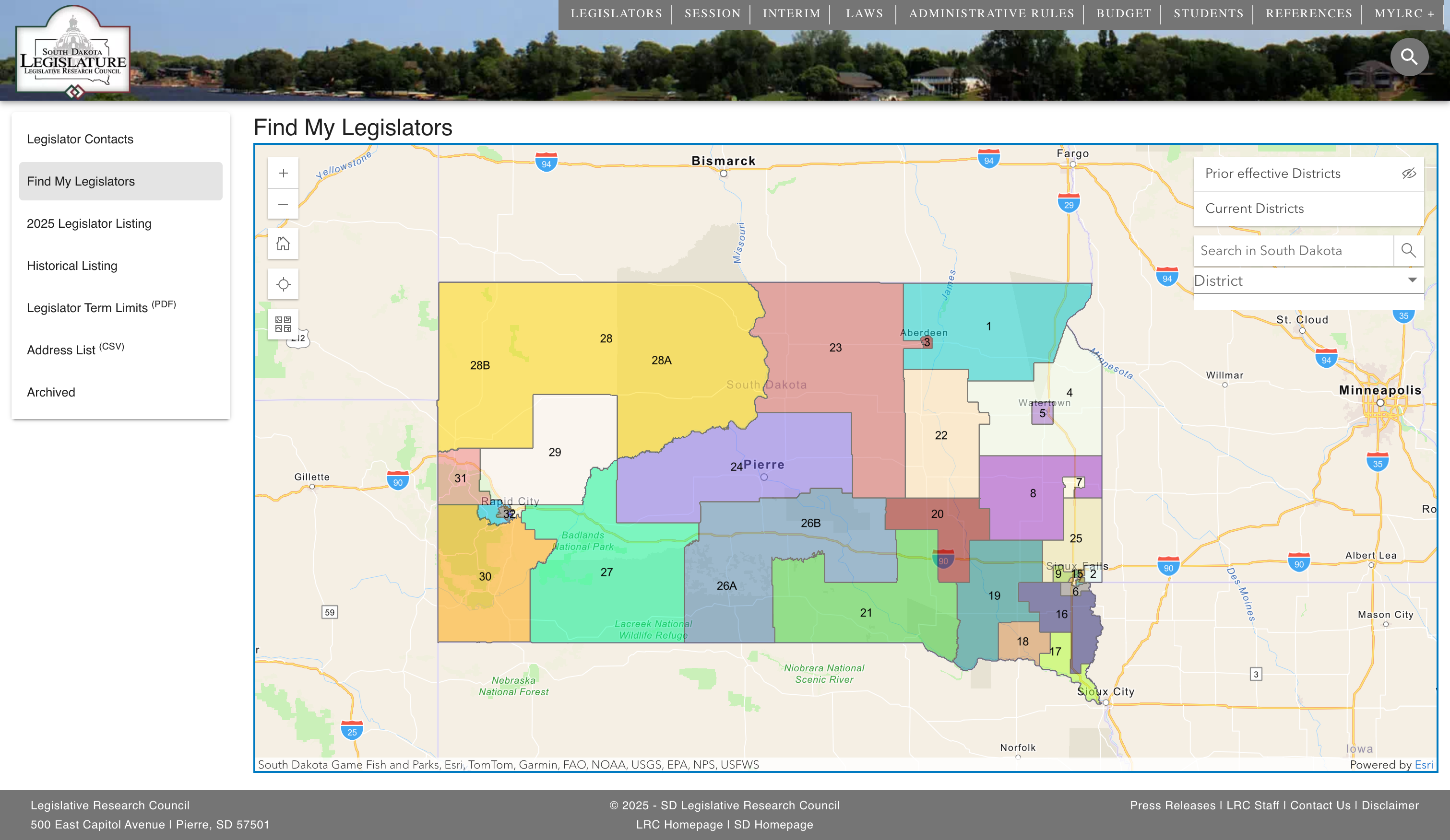
Click the image above to visit the SD Legislature website.
SD Legislative Map
This resource is provided by the State of South Dakota. The website offers an interactive tool to help you find your legislators and district information. Click on the image to access the full functionality at the SD Legislative website.